CALL TO ACTION: BEARS EARS NATIONAL MONUMENT
September 25, 2022
The BLM is holding a Public Scoping period for the Bears Ears National Monument (BENM) until 10/31/2022 to gather topics and criteria that the public thinks are important for the BLM to consider as they prepare the Resource Management Plan (RMP) and corresponding Environmental Impact Statement (EIS), required by federal legislation.
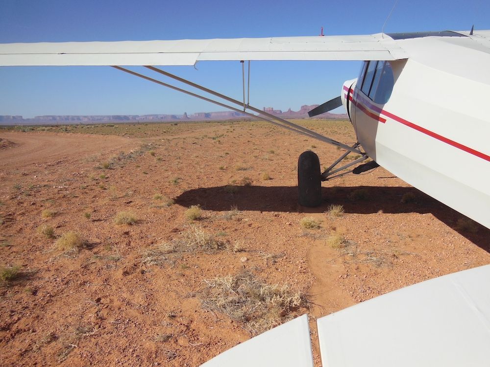
RAF Utah Liaison and Utah Back Country Pilots board member Wendy Lessig says, “It is essential that we encourage the BLM to include aviation as an allowed use in the BENM RMP. There are 22 scenic and popular backcountry airstrips either in or near the BENM that could potentially be affected. Please help preserve access to these treasured assets. Your voice counts!”
This is a separate BLM project from the recent Grand Staircase-Escalante RMP. Please submit your BENM comments directly to this link:
The deadline to submit public comments is OCTOBER 31, 2022
.
WE NEED YOUR HELP TO PRESERVE 22 OF
UTAH’S MOST SCENIC BACKCOUNTRY AIRSTRIPS
Here are talking points for reference. Please submit your own individualized comments based on the below:
- Aviation should be included in the RMP as an allowable use.
- Most Utah backcountry airstrips have been in existence since the 1950s, predating the 1964 Wilderness Act. Access and use of these airstrips should be retained.
- Aviation has a very small environmental footprint, the lightest footprint form of access to these lands. Airstrips do not have driving wheels and once landed, do not go “off trail.” Noise from aircraft is transient and of short duration.
- Airstrips are situated on natural flat land features, such as level, open meadows with little occurrence of soil disturbance or erosion.
- Airstrips provide vital access to aid Search and Rescue, emergency response, and firefighting.
- Airstrips offer possible life-saving options when small aircraft encounter mechanical problems or deteriorating weather conditions while flying over the relatively hostile terrain in southern Utah.
- Airstrips are an excellent resource to the administrative needs for supervising the lands.
- Airstrips transcend the need for roads and offer widely dispersed recreation activities.
- Peer-reviewed research substantiates that small aircraft noise has no detrimental impact on wildlife.
- Backcountry airstrips offer recreational access to the disabled and those with limited mobility and without the need for strenuous physical activity to enjoy our public lands.
- Airstrips are trailheads: aviators are non-motorized recreationists, participating in hiking, camping and other low-impact activities.
- Backcountry aviation offers a positive economic impact, with aviation fuel sales, food and lodging, sale of provisions and supplies, and other tourist-related support for the surrounding communities.
- The Recreational Aviation Foundation and the Utah Backcountry Pilots have successfully renewed MOUs in place with the BLM to provide cooperative maintenance of backcountry airstrips.
Your public comments count.
Thank you for helping preserve these unique and priceless
backcountry aviation assets.
These 22 airstrips are in or near the BENM and could potentially be affected:
AZ Minerals (03UT) – 37.1191 N / 109.9838 W
Browns Rim – 37.854 N / 110.2988 W
Castle Creek – 37.3995 N / 110.4713 W
Clay Hills Crossing – 37.317 N /110.3674 W
Dark Canyon North – 37.89585 N / 110.08898 W
Dark Canyon South – 37.8242 N / 110.0901 W
Deer Flat – 37.6654 N / 110.0271 W
Dry Fork Creek – 38.09334 N / 109.616 W
Fry Canyon – 37.6515 N / 110.1709 W
Hammond – 37.6843 N / 109.7732 W
Long Canyon – 37.7817 N / 110.15883 W
Mineral Canyon (UT75) – 38.5293 N / 109.9946 W
Mule Canyon – 37.4739 N / 109.7096 W
Needles Outpost – 38.1706 N / 109.7416 W
Nokai Dome – 37.2787 N / 110.5721 W
Paiute Canyon – 37.6495 N / 110.2989 W
Polly Mesa – 37.38772 N / 110.1237 W
Red Canyon Meadow – 37.57968 N / 110.17197 W
Red House Spring – 37.4815 N /110.1843 W
Rustler Canyon – 38.2724 N / 109.7263 W
Valley of the Gods – 37.25307 N / 109.9204 W
Wee Hope Mine – 37.5715 N / 110.224 W Dry Fork Creek – 38.09334 N / 109.616 W
Submitted on September 29, 2022.
Posted in News
